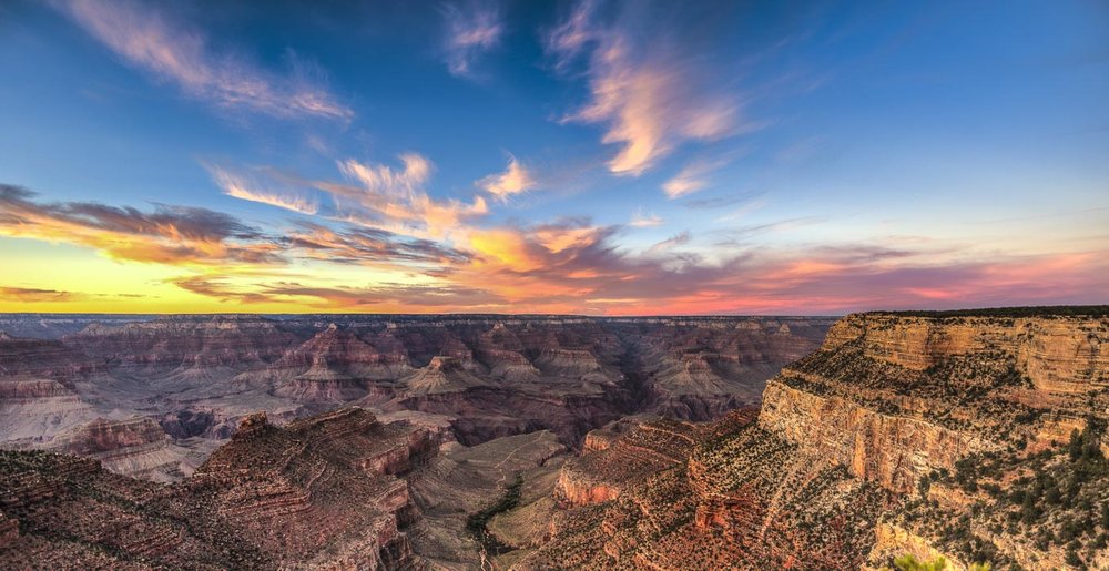
The Grand Canyon is for most visitors a must-see when they come to the Southwest. The National Park can be visited on each side of the Canyon - South Rim and North Rim. Each of them has beautiful Viewpoints. If you are really into hiking you can even do the Rim to Rim crossing from North Rim to South Rim and get the full Grand Canyon experience. This article will show you the best photography spots and Hiking opportunities and when to go where for the best light!
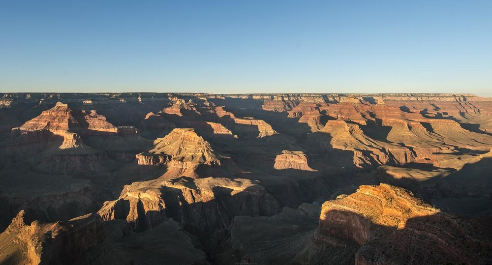
South Rim
When you’re going to go to Grand Canyon Nationalpark you’re most likely going to go to the South Rim. Here are more tourists but you also get the most iconic views. From there two of the trails start down into the canyon. The big campgrounds are also to be found here. The following link shows all the viewpoints along South Rim. Some parts of the roads are closed to private vehicles in summer months and can only be driven by national park busses.
Trails
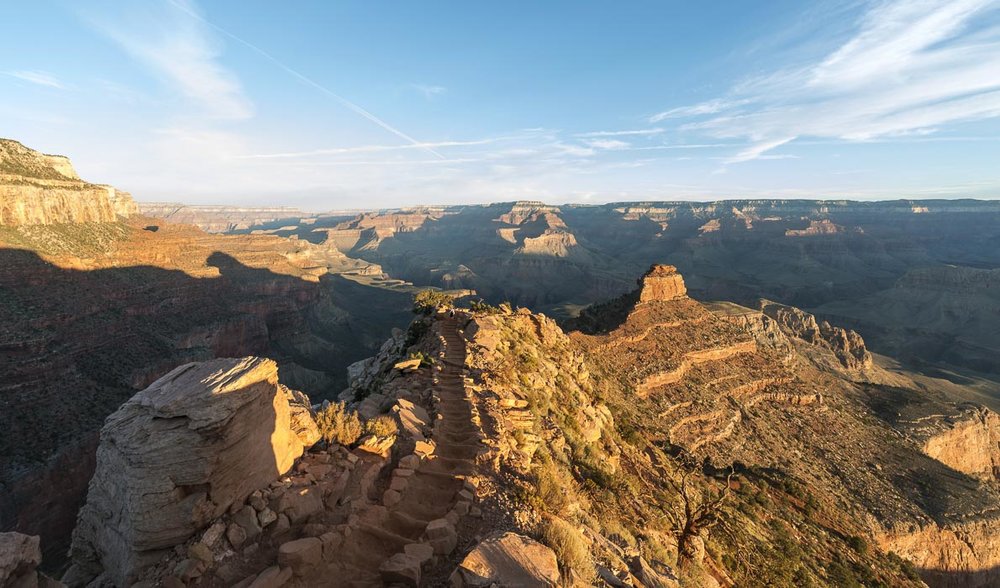
South Kaibab Trail
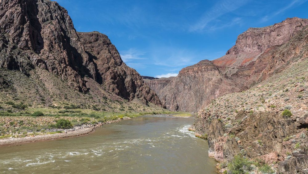
The South Kaibab Trail is one of the two paths down to the river. The trail leads in 10 km (6,5 miles) with an elevation gain of about 1500 m (4.793 feet) down to Phantom Range Campground in the canyon. National Park Services warns you to not walk down and up again in one day because of the length and heat. The problem is that you need to make reservations for the campground many months in advance and it is (nearly) impossible to get a space for spontaneous people like us. But as we are used to walking long trails we decided to give it a try. We started our walk down at about 5 AM with a few other people. We saw the sun rising and had beautiful light and views as we walked down. It was quite a long and as we hiked over the bridge over the Colorado river we were happy to get a break. We had lunch and a swim in the river while we watched some whitewater rafters getting a rest there too. At some point, we had to start our walk up again. So we began to walk up Bright Angel Trail.
Bright Angel Trail
The Bright Angel Trail is more famous. Here most of the Canyon Crossing People walk up. The walk down from North Rim and go up to South Rim which is even a little bit longer than our trip. The total length from top to Phantom Range is 15,5 km (9,6 miles) with again an elevation gain of about 1500 m (4.793 feet). As we walked up the trail we passed the campground and crossed the river again before the trail was getting steeper. It was a strenuous hike up and the further we came up the more breaks we needed. Also the people got more the further we went up as many of them had to make lots of breaks. Indian Garden campground is at about half of the trail and is also a nice destination for a shorter walk from the Rim. As you already see the Rim from about the last 3 miles you think that the end must be near. But then again you look at the map and it says 2 miles…
We were really happy when we reached the Rim at about 6pm. Then we got some ice cream and watched the sunset from the viewpoint there.
Viewpoints
There are lots of viewpoints along the Rim. You can see most of them if you walk along the Rim Trail which leads from South Kaibab Trailhead to Hermits Rest. You can rent bikes at the visitor center too if you like to cycle along the Rim. You can divide the viewpoints in that west from the village (which are only accessible by bus in summer), the ones around the visitor center and the vill age and the ones east of the village.
Eastern Viewpoints - From Pipe Creek Vista to Desert View Watchtower
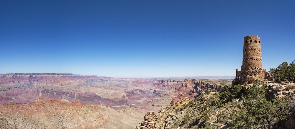
To these Viewpoints (except Kaibab Trailhead and Yaki Point) you can drive with your car but be prepared that the parking lots can be full. From these viewpoints you can get nice photos at sunrise.
Village Viewpoints - from Mather Point to Bright Angel Trailhead
Normally the Viewpoints around the National Park Center are the most crowded ones. Even though Mather Point offers a nice view and as most people visit the Visitor center anyway its just on the way. Another nice view also for sunset offers the promenade along the Rim at Bright Angel Trailhead. You can get some drinks and food and watch the sunset.
Western Viewpoints - From Bright Angel Trailhead to Hermits Rest
To get to these viewpoints you have to take the bus. Some offer great views for sunset. For example at Pima Point or the Viewpoints from Mohave to Maricopa Point.
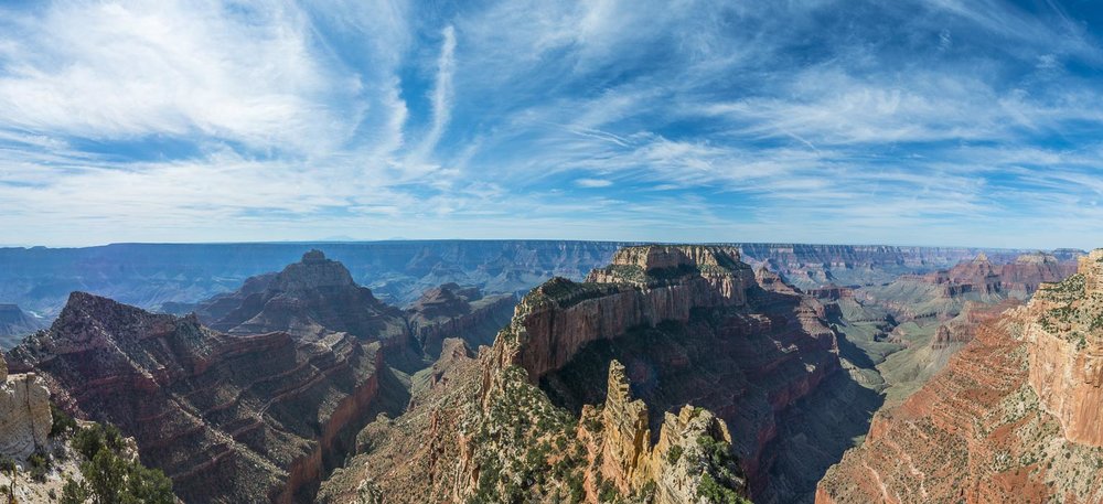
North Rim
Grand Canyon North Rim is much smaller than South Rim and there are fewer opportunities for camping and overnight staying. Its also quite a drive from the next bigger road. But if you like it more quiet and smaller North Rim is the right choice. The viewpoints here are quite nice to and you are nearly alone. For the detailed locations of the viewpoints see the link below.
Viewpoints
Bright Angel Point
Bright Angel Point is just a short walk from the Grand Canyon Lodge and also the first viewpoint along the North Rim. From here the Cape ROyal Road leads you two the two other main areas Cape Royal and Imperial Point.
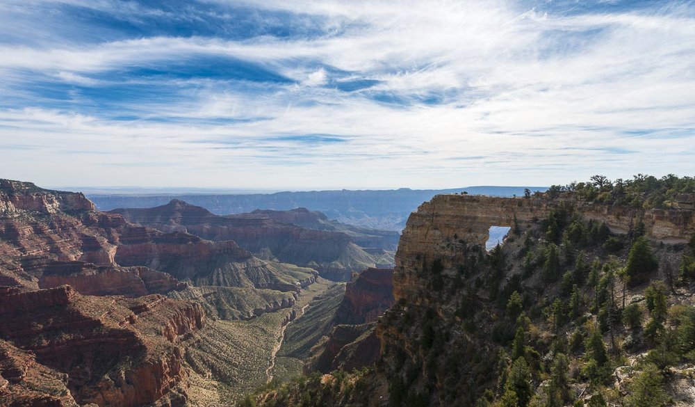
Cape Royal
To get to Cape Royal you drive over the Walhalla Plateau. Along the way you can stop at Roosevelt Viewpoint and take a hike to Cape Final Viewpoint. Cape Royal is famous for Angel’s Window, a hole in the rock, which looks quite cool. The view over the Canyon at the viewpoint is also really nice and a great spot for sunrise or sunset. This was probably our favourite spot on North Rim.
Point Imperial
The Grand Canyon Vista of Point Imperial offers the highest view over the Grand Canyon. Here the Canyon also looks a bit different as the canyon and mesa rock structures are less distinctive. The dominant rock formation here is Mount Hayden.
Explore more like this
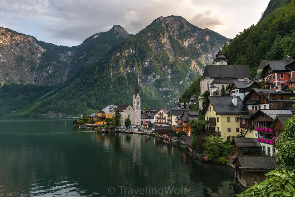
Multi-Day-Hike around Hallstatt - in 5 days around Dachstein and Gosaukamm
The Salzkammergut offers many wonderful opportunities for hiking. Our five-day hike starts in the beautiful town of Hallstatt on Lake Hallstatt and takes us around the Dachstein massif and Gosaukamm....
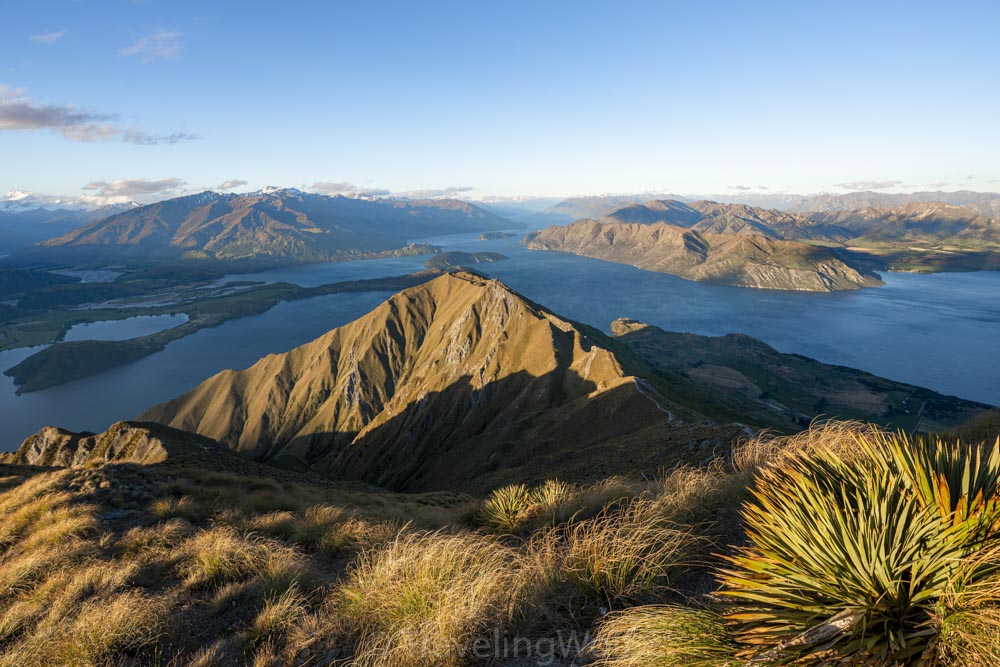
The 4 Best Day Hikes around Wanaka in New Zealand
Wanaka is a great place for mountain and water-related outdoor activities in summer and winter. The town is located on the North end of Lake Wanaka and famous for The...
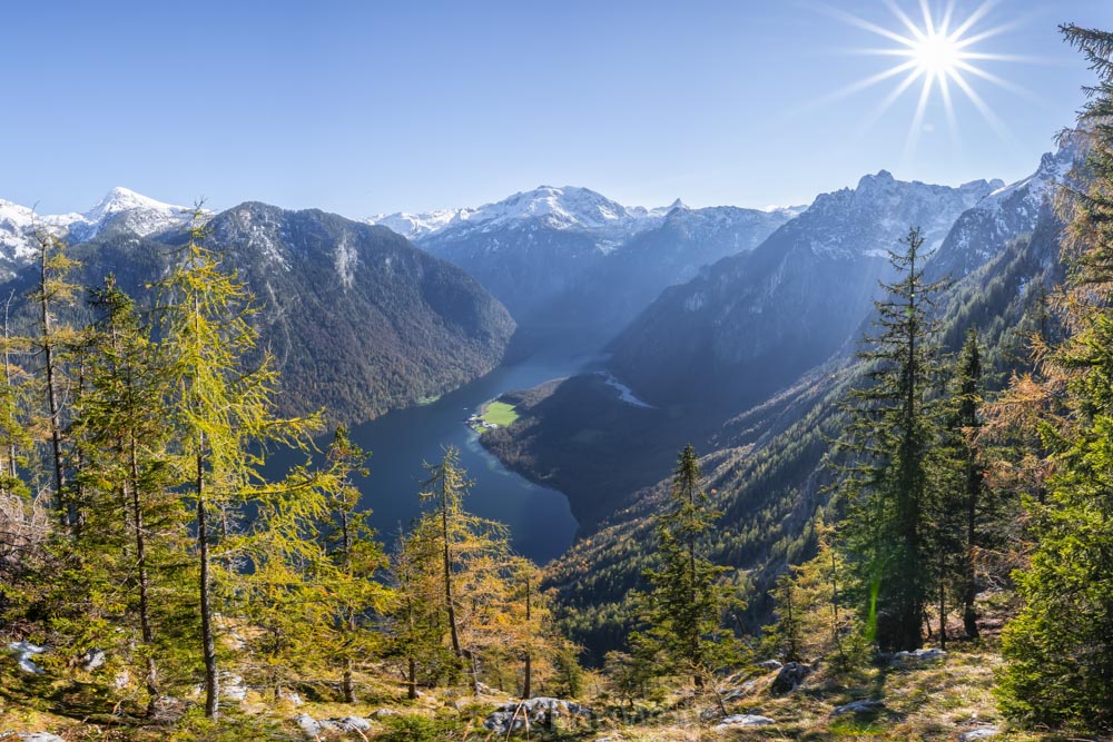
Alps scenic Hikes - Hike to Archenkanzel at Lake Königssee
One of the most famous views over the Königssee besides Jenner and Malerwinkel offers the viewpoint at Archenkanzel. From there you can see down to St. Bartholomä and the Königssee...
Inselhüpfen auf den Kykladen - eine zweiwöchige Reise nach Griechenland
Die Kykladen sind eine Gruppe von griechischen Inseln in der südlichen Ägäis. Sie sind vor allem für ihre weißen Städte mit kleinen gepflasterten Straßen und für die typischen weißen kykladischen...
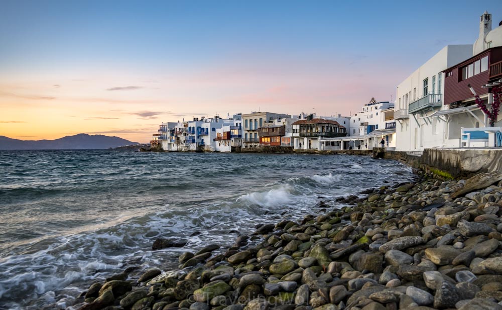
Island Hopping on the Cyclades - a Two Week trip to Greece
The Cyclades are a group of Greek islands in the southern Aegean Sea. They are mostly known for their towns with small streets and typical white Cycladic houses. The most...
Comments