Last Summer we went on this amazing 5-day trekking trip along the Schladminger Tauern Höhenweg. The hike starts at the Austrian town Schladming, which is about 2 hours from Salzburg by car. We had a wonderful time walking through the beautiful alpine landscape along a great amount of little and big lakes and catching some stunning views from the mountain tops. That’s why we want to share this experience with you !
The full tour takes about 5 days. It can easily be shortened to 3 days if you have less time. I will describe the 5-day tour and will mention drop-in or drop-out points along the way. As always, I will write down a packing list especially for those who haven’t gone multi-day-hiking in the Alps before. Also, please check the weather before you start as a storm can come up fast and is dangerous in high areas!
The map below shows the whole tour from Hochwurzen to Planai including the side trip up to Hochgolling. The huts and some remarkable peaks are marked as waypoints.
Day 1: Hochwurzen to Ignaz-Mattis-Hütte
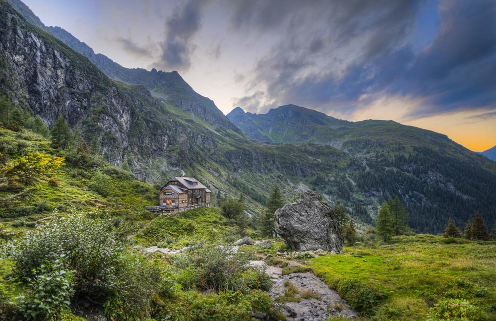
The first day’s march is about 9,7 km and 700 m elevation if you start the tour from the top of Hochwurzen. From Hochwurzen you get the first nice views, especially of the upcoming trail route. The trail is mainly even until you reach the lake Brettersee. This is the first swimming opportunity on our way and won’t be the last! After you have reached the lake the trail leads only down. At some point, you get an incredible view over the Giglachseen and you can see Ignaz-Mattis-Hütte from there, too. From there its just a short walk to the hut. They have amazing food and a beautiful view there.
Drop Out/In: You can acces Ignaz-Mattis-Hütte from Schladming.
Day 2: Ignaz-Mattis-Hütte to Landawirseehütte via Keinprechthütte
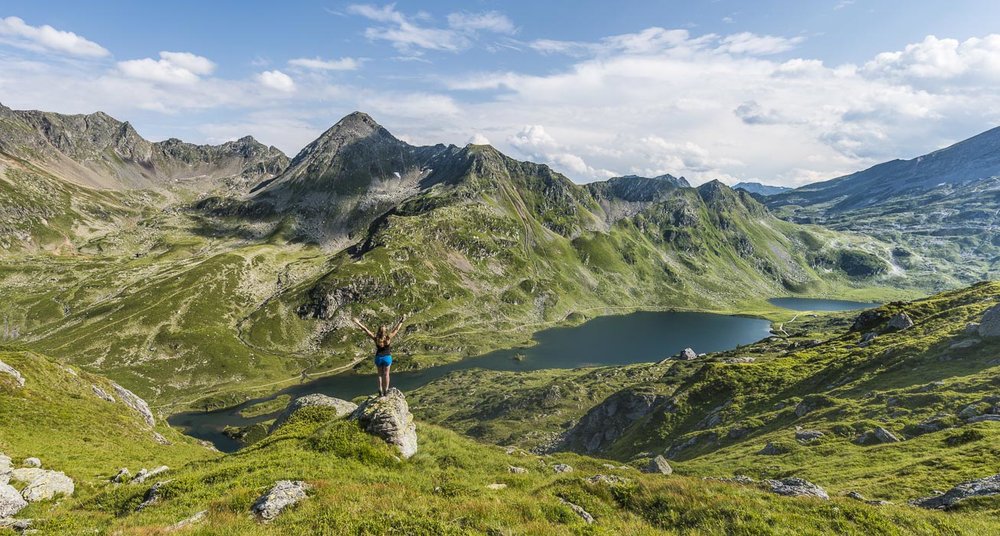
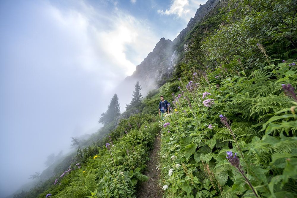
The second stage is about 10 km long with 800 m in elevation. If you stay at Keinprechthütte the tour is about 6,5 km but you have to walk the remaining 3,5 km the next day. From the hut the trail leads you down to the lakes in the morning. Here are many nice photo spots. From there the trail goes up to the 2453m high Rotmandlspitz. Then it leads down to Keinprechthütte. We made a break by the lake near the hut and went swimming there. After that, the trail goes up again until the Trockenbrotscharte. As this was the second time we hiked up on that day we were really happy when we arrived at the top. From up there you get the last views of the day and you can already see Landawirseehütte and the two lakes Upper and Lower Landawirsee. They are another good opportunity to take a morning or afternoon swim.
Drop Out/In: Keinprechthütte is accessible from Schladming. It is also possible to walk up to Landawirseehütte from Hintergöriach, but there is no easy connection back or from Schladming to Hintergöriach.
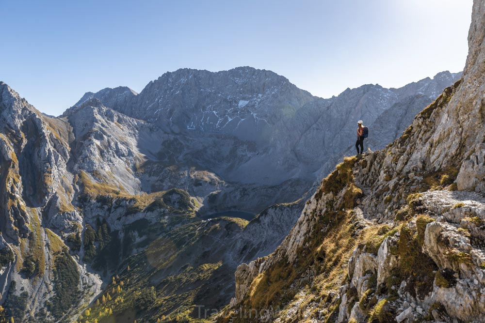
Day 3: Landawirseehütte to Gollinghütte via Hochgolling
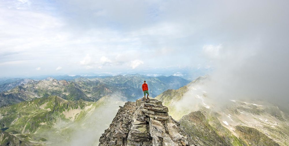
Day 4 is a 5km walk with 700 meters elevation if you just walk from Landawirseehütte to Gollinghütte. If you like a nice view you can climb up to 2862m high Hochgolling on your way. That makes another 3 km and 500 m elevation up and down. Be careful as you start your way from Landawirseehütte. The upper trail is not easy to find and is also quite steep. We did the tour including Hochgolling which was fantastic but the way down totally destroyed my knees as it is about 1300m down in total. Gollinghütte lies in a nice valley beyond a little stream that invites for a freezing bath. The hut with the stream is really photogenic as well.
Drop Out/In: It is possible to walk from Gollinghütte down the valley to Schladming if you want to stop or start your trip from here.
Day 4: Gollinghütte to Preintalerhütte via Greifenberg
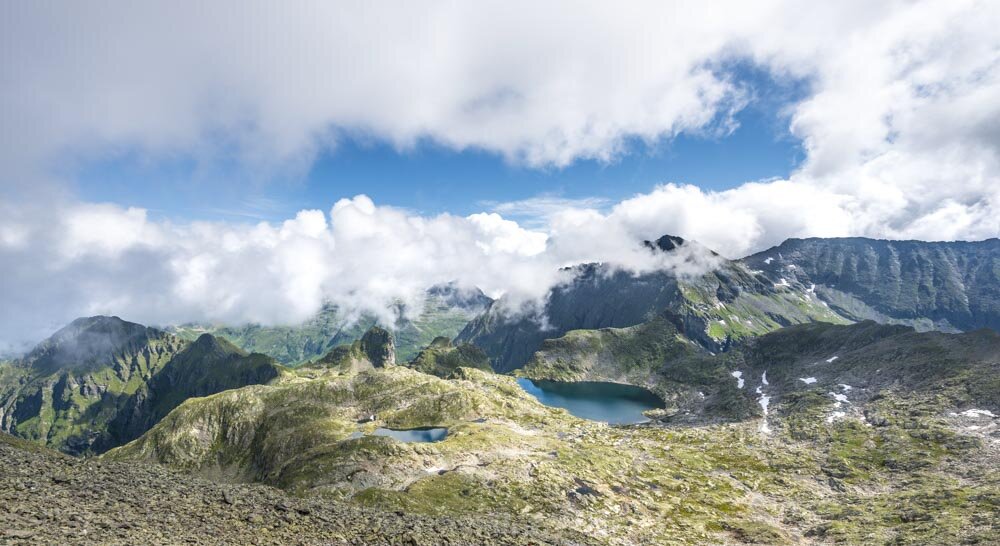
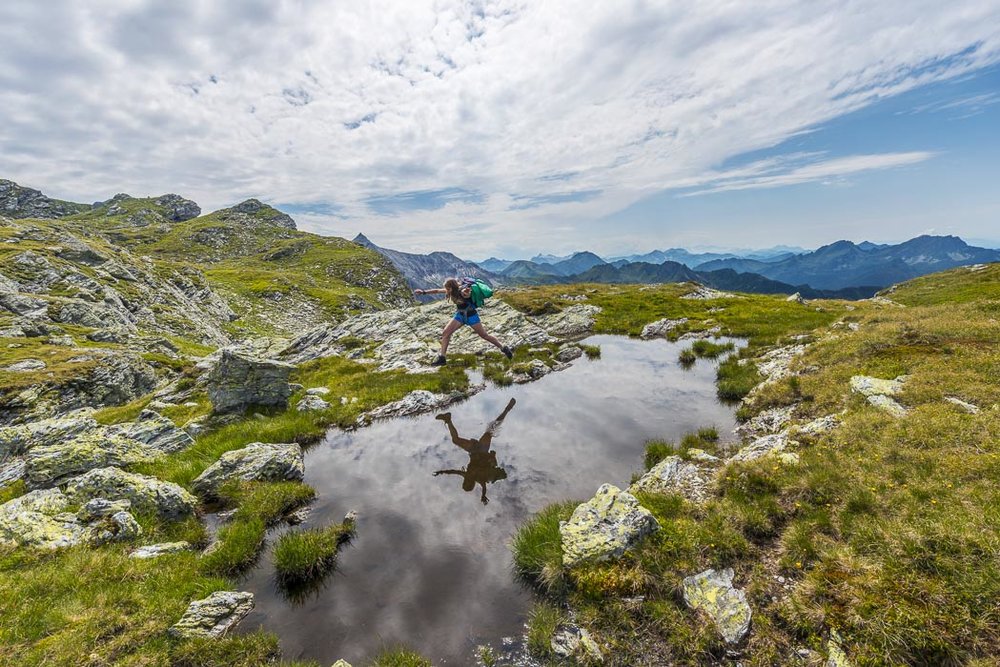
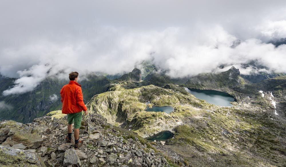
Day 4 is in total about 8,3 km and 1000 meters of elevation. The day starts with a steep and long walk up to 2618 m high Greifenberg. As Gollinghütte lies at about 1600 m you have a 1000 m climb in the morning. But you will get rewarded. From the top the view down into Klafferkessel is incredible with many little lakes . The trail goes down into Klafferkessel afterward and you can take nice pictures with people mirroring in the lakes’ surfaces. Of course, this is another good opportunity to swim. Again it is a long way down in the valley until you walk around a curve and suddenly Preintalhütte appears. At Waldorfalm next to the hut you can also get some nice Brotzeit and a Buttermilch.
Drop Out/In: You can walk from Preintalerhütte down to Untertal from where Schladming is accesable via bus.
Drop Out Day 5: Preintalerhütte to Untertal Via Riesachsee and Wildes Wasser
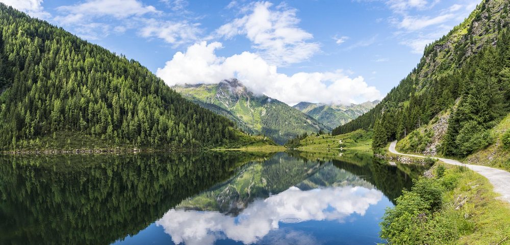
We decided to take the drop out point from Preintalerhütte to the end of Untertal from where you can take the bus back to Schladming or again walk to Schladming. The hike down offers some nice photogenic views like the mirroring of the mountains in Riesachsee, a big lake that you pass on the way down. It is also a nice place for a swim and also the last lake on our trip. Adding to that the trail leads you along the ravine Riesach also called Wildes Wasser, which is quite cool with some waterfalls. At the end of the river you get to the street from where you can take the bus back to Schladming. We decided to walk back but its quite a long walk, especially because we were already walking the past 4 days.
Day 5: Preintalerhütte to Planai
The last part of the Trip leads you from Preintalerhütte to the top of Planai cable railway. From there you can walk down by foot or take the cable railway down to Schladming. We didn’t walk this last part of the tour, so we can’t give you many details about it. If you hiked there please send us an email or write a comment about your experience!
📌 Pin it on Pinterest:
Explore more like this
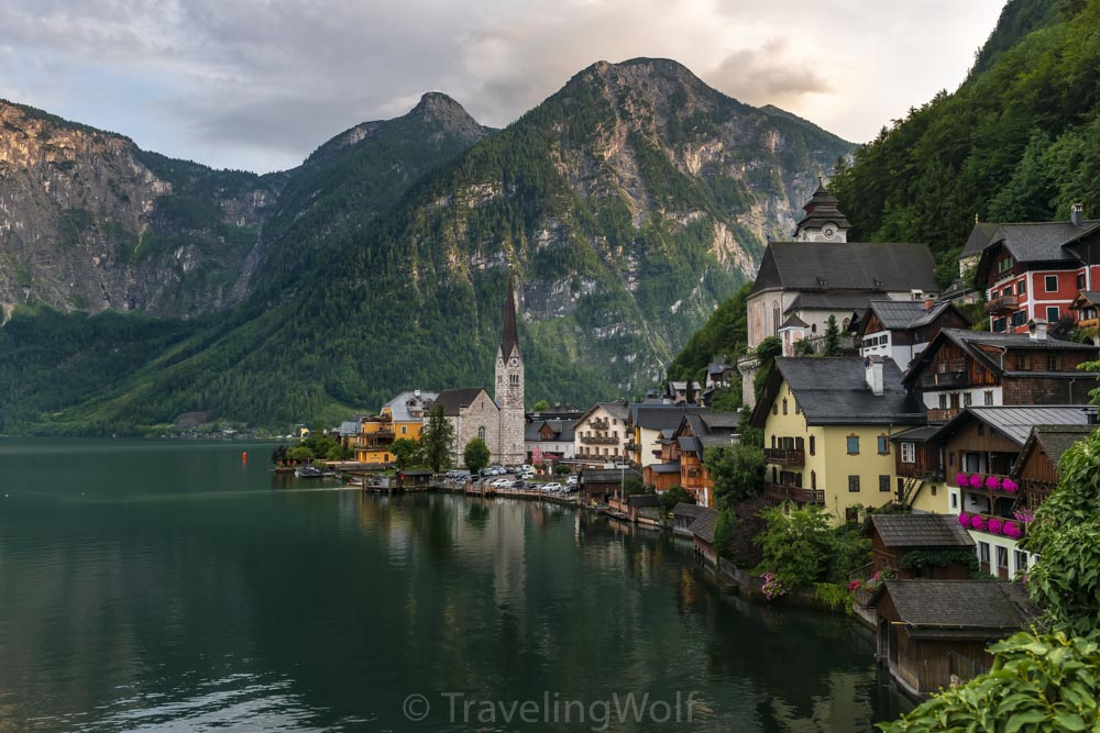
Multi-Day-Hike around Hallstatt - in 5 days around Dachstein and Gosaukamm
The Salzkammergut offers many wonderful opportunities for hiking. Our five-day hike starts in the beautiful town of Hallstatt on Lake Hallstatt and takes us around the Dachstein massif and Gosaukamm....
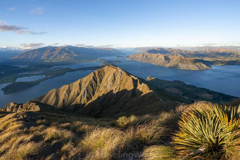
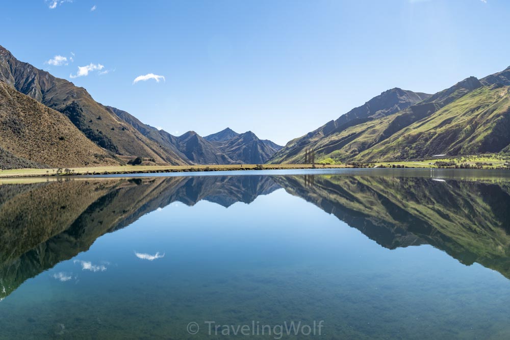
The 4 Best Day Hikes around Wanaka in New Zealand
Wanaka is a great place for mountain and water-related outdoor activities in summer and winter. The town is located on the North end of Lake Wanaka and famous for The...
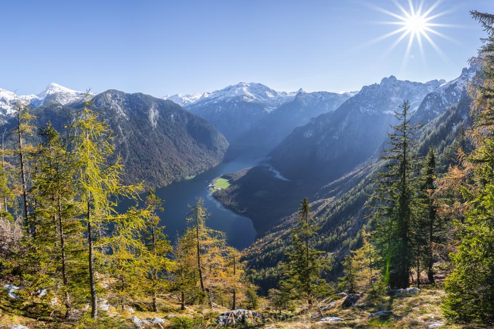
Alps scenic Hikes - Hike to Archenkanzel at Lake Königssee
One of the most famous views over the Königssee besides Jenner and Malerwinkel offers the viewpoint at Archenkanzel. From there you can see down to St. Bartholomä and the Königssee...
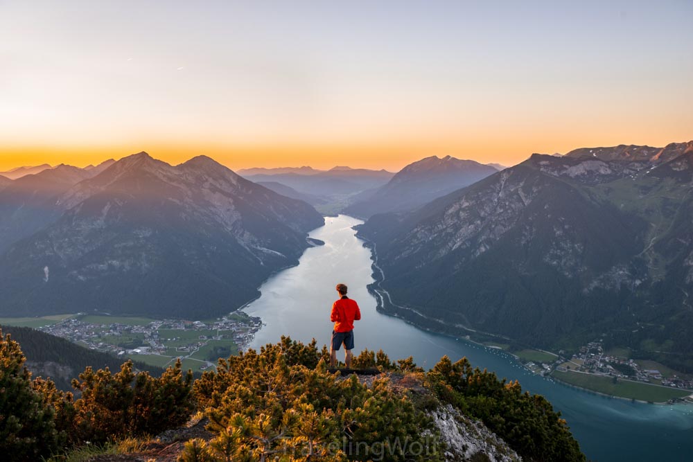
Alps Scenic Hikes - Bärenkopf at Lake Achensee
Bärenkopf is one of our favorite sunset spots when we are on a weekend trip in the Alps. The view from the top over Achensee reminds me of the fjords...
The 5 Best Day Hikes around Queenstown in New Zealand
Queenstown is known for its adventure tourism and skiing areas. It is a good place for sky diving surrounded by thrilling mountain landscape, like the Remarkables mountain range and Lake...
Comments