Queenstown is known for its adventure tourism and skiing areas. It is a good place for sky diving surrounded by thrilling mountain landscape, like the Remarkables mountain range and Lake Wakatipu. The surrounding mountain ranges also invite to explore them by foot. We will show you 5 scenic hiking trails around Queenstown and the village of Glenorchy you should not miss on your trip to New Zealand.
Around Queenstown
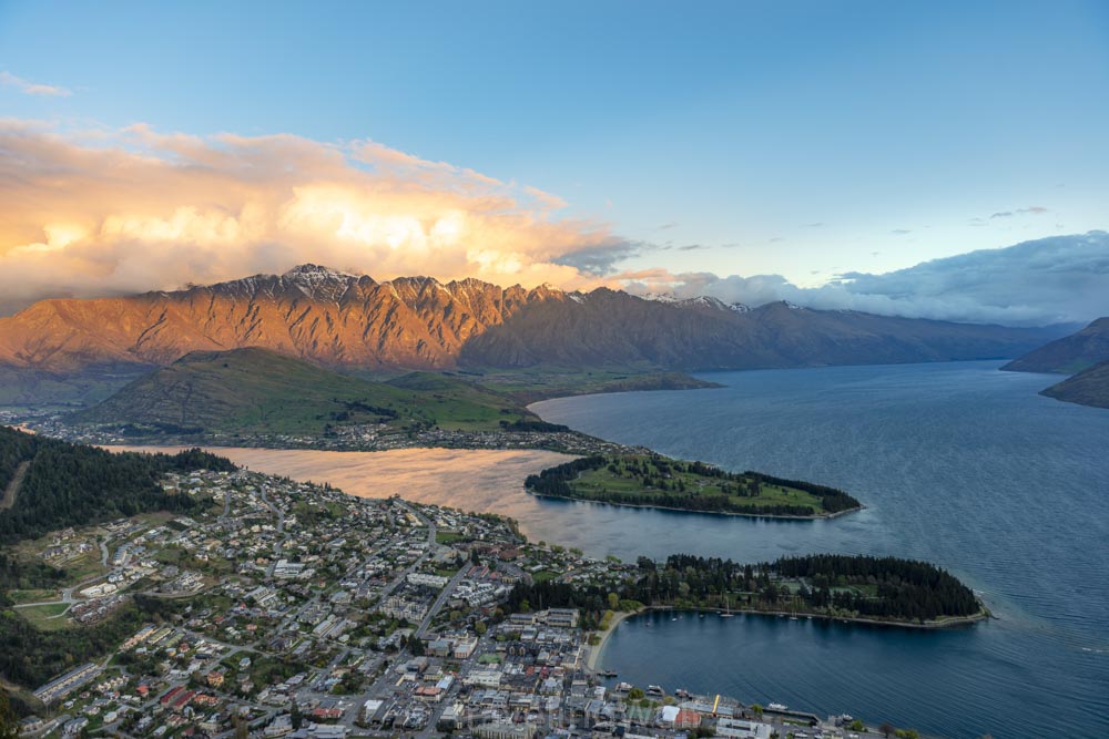
Queenstown is sitting on the lakeshore of Lake Wakatipu and has a nice lakeshore promenade with cafes and restaurants. There are multiple companies offering boat trips and jet skiing on Lake Wakatipu as well as kayaking trips. There are also many opportunities to go skydiving, which had been on our bucket list for some time. Prices start at about 120 NZ$ for a simple skydive from about 4000m with about 45s free-fall and 10min gliding with views of the Remarkables and Lake Wakatipu. Queenstown is also nestled between the SKi Areas of Coronet Peak and The Remarkables for those of you who visit in winter. In summer they offer paragliding from Coronet Peak area. In Queenstown you can also find the SKyline Gondola leading up to a viewing platform with great views above Queenstown. If you are into mountain biking you can spend a day on the mountain bike downhill trails starting from Skyline Gondola. But Skyline Gondola is also the starting point for our first hike.
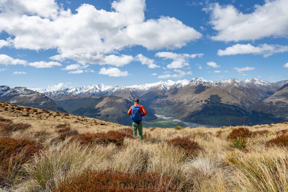
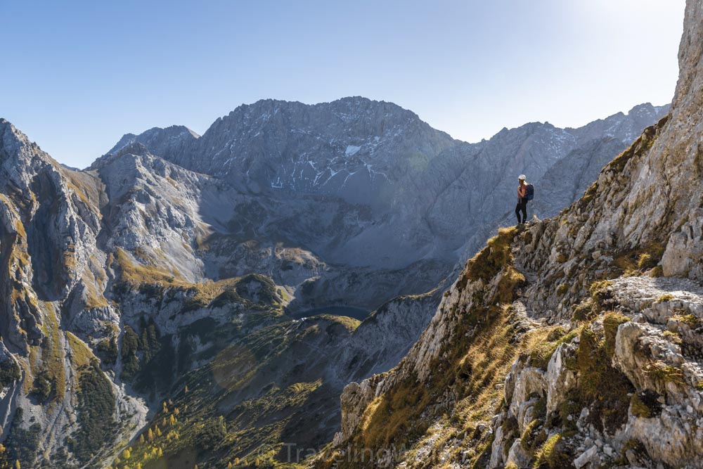
1. Ben Lomond
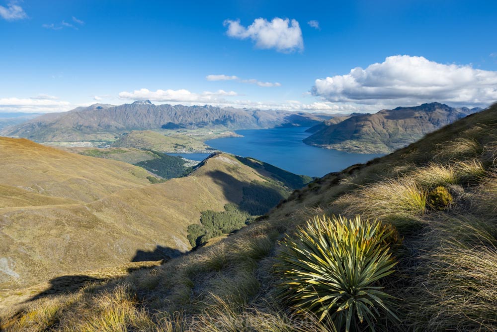
Ben Lomond is the mountain peak located directly behind Queenstown. From there you get views over Lake Wakatipu and Queenstown to the Remarkables mountain range and also to the summit of Ben More. Ben Lomond is a nice place to watch the sunset.
The hike starts either directly in Queenstown or from the top of the skyline Queenstown gondola. I would recommend to take the ropeway and start from here as the first part of the trail only leads up through the forest with little to no views. From the gondola station you start hiking up further along the luge track. The trail then leads through a short forest area and continues up on grassy hills.
When you reach Ben Lomond saddle the views start to get better. After some more time you reach the summit from which you can look view Queenstown, Lake Wakatipu, the Remarkables and more. If you stay there for sunset you can watch the Remarkables mountain range colored in deep red in the last sun.
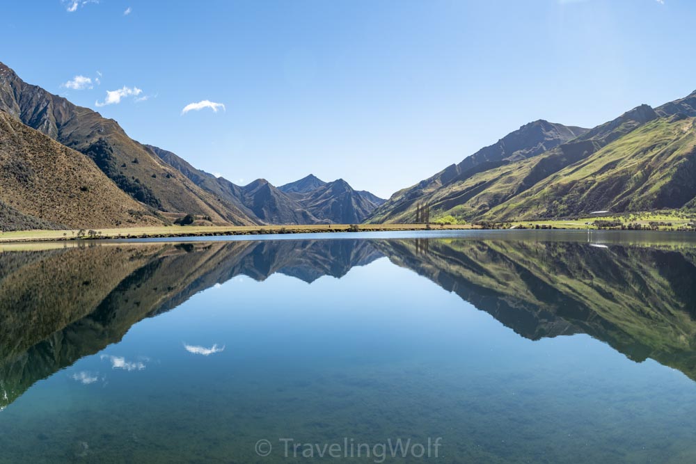
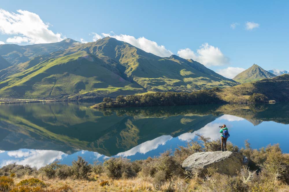
2. Moke Lake Loop Track
Moke Lake is a little lake close to Queenstown, accessible on a small gravel road. There is also a Campground at the lake, which was our favorite one around Queenstown. The lake is nestled between grassy hills and is a nice idyllic spot off the beaten track. There is a trail leading around the lake which is nice to walk on a calm day when the mountains around reflect in the lake. The trail starts at the campground and from there leads around the West side of the lake. Then you walk on into the lake’s inlet. From there you can take nice pictures of the opposite valley. This spot is great for a picnic or a swim in the lake on a hot summer day. The last part of the trail leads back to the campground along the gravel road.
Around Glenorchy
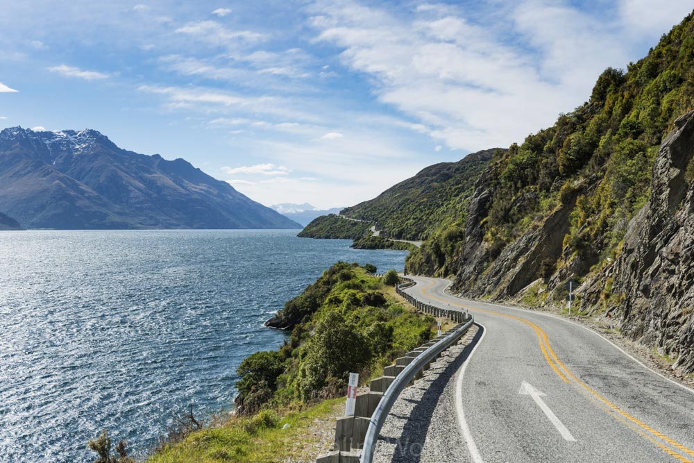
The next hikes start around the village of Glenorchy next to Queenstown at the end of Lake Wakatipu. The road along Lake Wakatipu shore is also really nice. There are a few viewpoints like Bennets Bluff Lookout and beaches like Bob’s Cove and Wilson Bay along the road to stop by with views over the lake and swimming and kayaking opportunities. At Bob’s Cove, there is also a short trail leading to a lookout point above the lake.
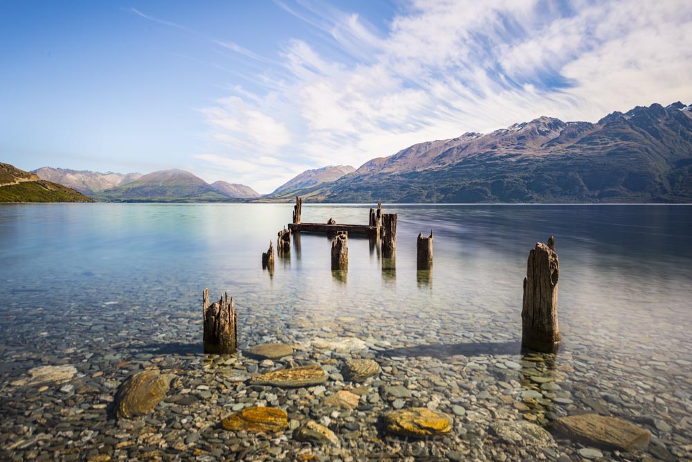
Glenorchy itself is a really small village and is famous for the red Glenorchy hut on the shore. On Dart River you can do Wildwater rafting trips or off-road drives in the river delta. The Dart River delata looks really cool with its multiple winding river flows and there are a few lookouts along the Road to Kinloch like Isengard Lookout. If you have some time you can also drive along Rees River on the Road to Paradise, which leads to Diamond Lake at from where you have nice views of the surrounding mountains. For Camping I recommend staying at Kinloch Camping Area. The campsite is located directly at Lake Wakatipu and you get nice mirroring of the mountains for sunrise from there.
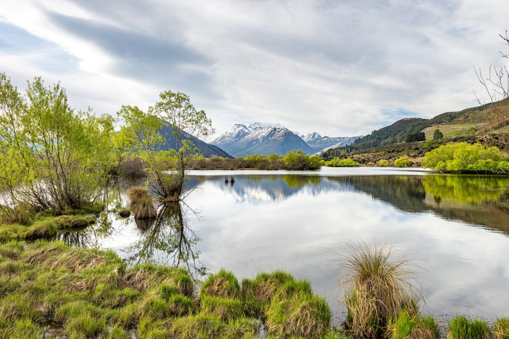
3. Glenorchy Lagoon
Glenorchy lagoon is a great place for sunsets. There is a walkway around and through the lagoon from which you can see the mountains nicely mirrored in the lake. There is also a really photogenic bench with a nice view in the middle of the lake along the walkway. The trail around the lagoon is not very long and is suitable for an evening walk to enjoy a calm sunset.
4. Mount Alfred / Ari
Mount Alfred is the first mountain directly on the end of Lake Wakatipu. It rises magestically between the Valley of Dart River and Rees River and thus is the perfect lookout point. To hike the trail it takes about 6 - 8 hours out and back.
The track starts from a parking lot at the Glenorchy - Routeburn Road. Although the trail isn’t marked in the common maps of komoot.com or maps.me it is easy to find. From the parking lot the trail leads up and further up through the forest. There the trail is marked with red arrows and easy to find. When you reach the forest line you are nearly on the top.
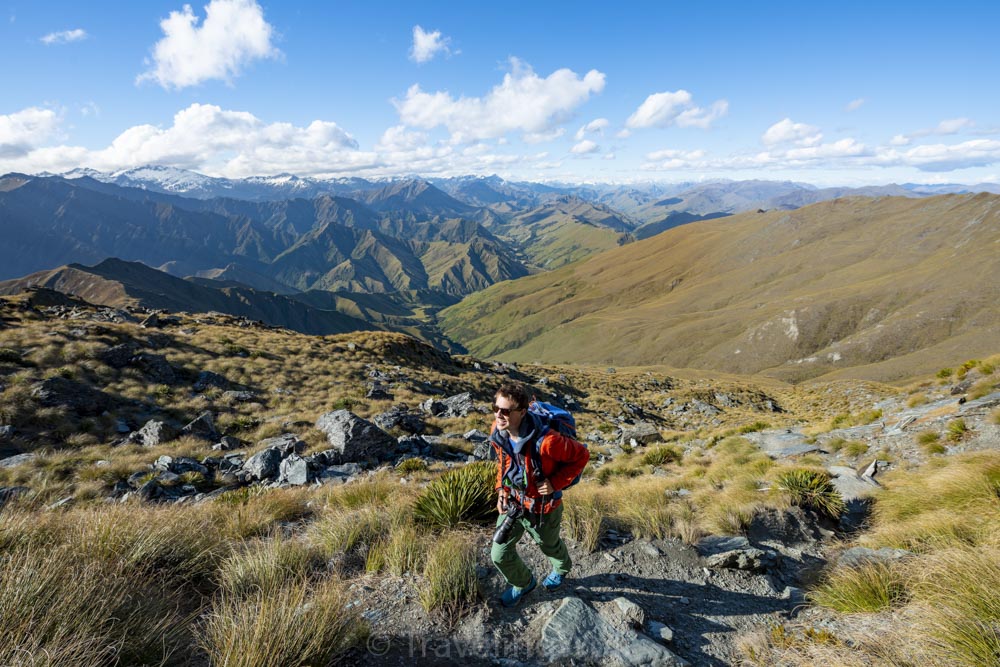
From the end of the forest the marked trail ends, but there are many obvious route options you can take to get to the summit ridge. Be aware that the land around Mount Alfred is privately owned, so don’t disturb the life stock and be responsible. The trail now leads through grassland and you get the first views of the panorama around. The last parts of the trail require some scrambling. After that, you reach the summit after a short time.
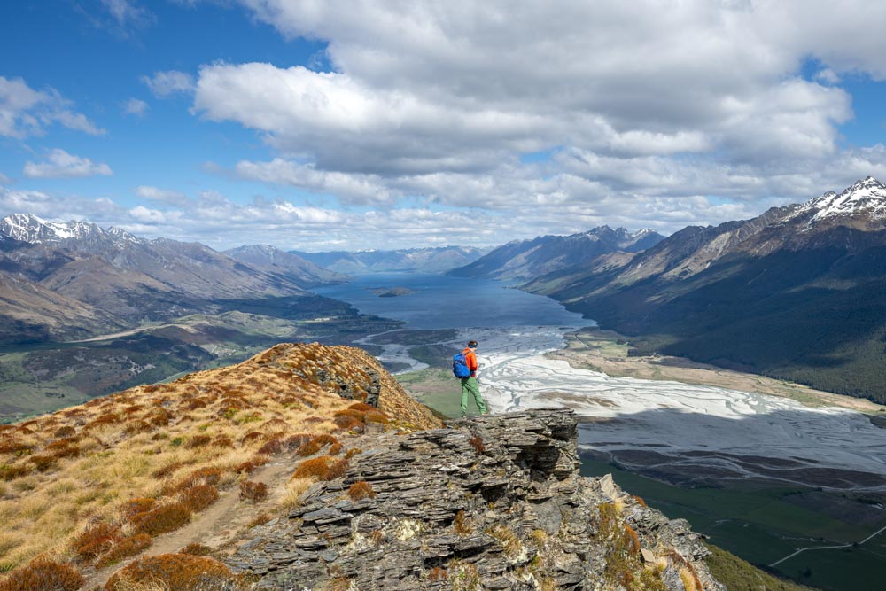
From up here the view is incredible. On one side you see Dart River Delta with all the winding river arms and the snow-covered mountain tops above. On the other side you look down to Rees River valley. When you walk to the front end of Mount Alfred’s ridge you get incredible views over Lake Wakatipu. If you walk further back on the ridge you can see into the mountains along Dart River Valley and tot Turret Peak and Mount Earnslaw. The summit lets you experience a 360-degree panorama of the Southern Alps. Although the hike is quite strenuous and long all the effort is worth this perfect panorama, so don’t miss this hike on your trip to Queenstown!
5. Lake Harris
At the end of the Glenorchy - Routeburn Road starts Routeburn Track, one of New Zealand’s Great Walks. The whole trail normally takes about 2 to 3 days. But it is possible to walk parts of the trail on single-day hikes that will show you the beauty of Routeburn Trail. We have written a blog article about Routeburn track, which you can read about here, that describes two day-hikes we made, that include most parts of the trail.
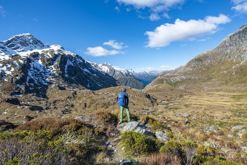
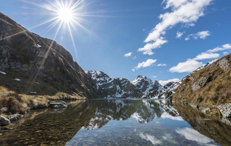
The first part of the trail leads along the Routeburn River and through a forest area. At some point you reach Routeburn Flats, an area where the river bed gets wider and the forest clears up so you can see the mountains surrounding the valley. From that point the trail leaves the valley and winds up the mountain side following the left branch of Rout Burn. After hiking up for some time you arrive at Routeburn Falls Mountain Hut which is the first stay for most people on Routeburn Track. After the hut we reach the forest line and the trail now leads through grassy landscape further up. From here you can see Route Burn in the valley down below and get a glimpse of the (in spring) still snow-covered peaks. Passing a flat area with small ponds the trail becomes steeper again until we finally reach Lake Harris. In spring there is often still snow on the hills around and on a calm day you have a perfect mirroring of these mountains in the lake. If you like you can continue on to Harris Saddle with views into Hollyford River Valley on the Fiordland Part of Routeburn Track. Lake Harris is the perfect spot for a picnic before you start your long way back.
Explore more like this
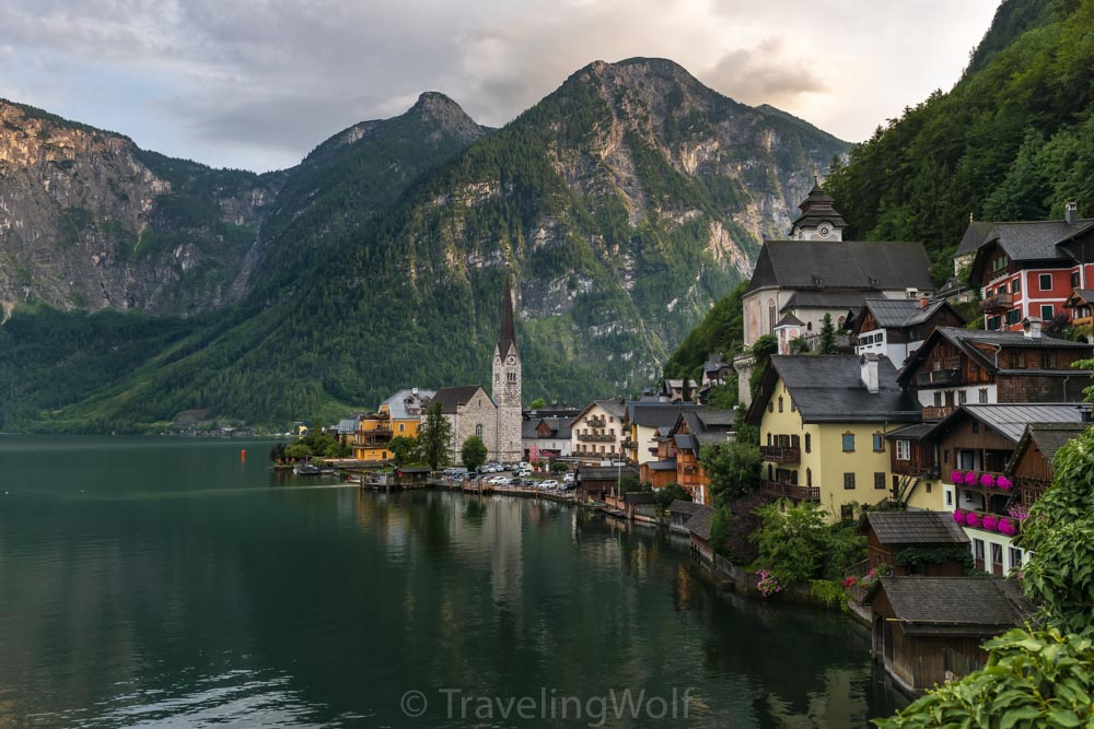
Multi-Day-Hike around Hallstatt - in 5 days around Dachstein and Gosaukamm
The Salzkammergut offers many wonderful opportunities for hiking. Our five-day hike starts in the beautiful town of Hallstatt on Lake Hallstatt and takes us around the Dachstein massif and Gosaukamm....
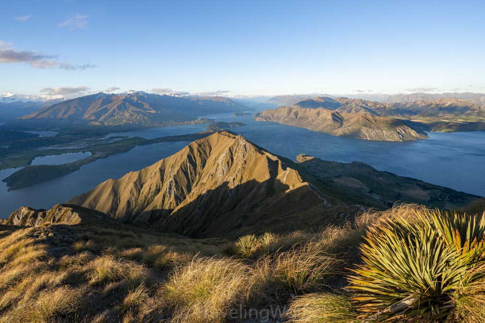
The 4 Best Day Hikes around Wanaka in New Zealand
Wanaka is a great place for mountain and water-related outdoor activities in summer and winter. The town is located on the North end of Lake Wanaka and famous for The...
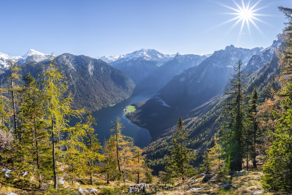
Alps scenic Hikes - Hike to Archenkanzel at Lake Königssee
One of the most famous views over the Königssee besides Jenner and Malerwinkel offers the viewpoint at Archenkanzel. From there you can see down to St. Bartholomä and the Königssee...
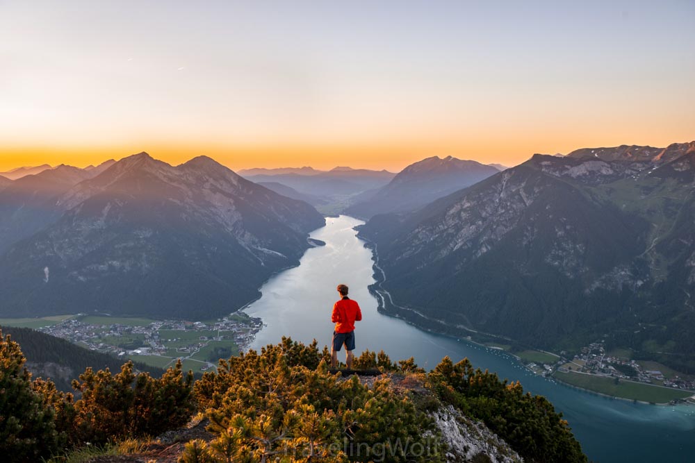
Alps Scenic Hikes - Bärenkopf at Lake Achensee
Bärenkopf is one of our favorite sunset spots when we are on a weekend trip in the Alps. The view from the top over Achensee reminds me of the fjords...
Alps Scenic Hikes - From Ehrwald to Lake Seebensee and Ehrwalder Sonnenspitze peak
This hiking and climbing trail starting from Ehrwald in Tyrol leads you along many incredible photo spots to lake Seebensee passing Lake Drachensee at Coburger Hütte and on a demanding...

Comments